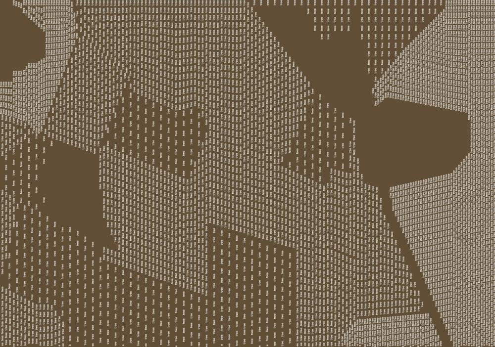
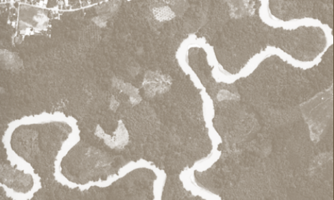
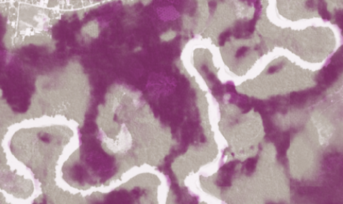
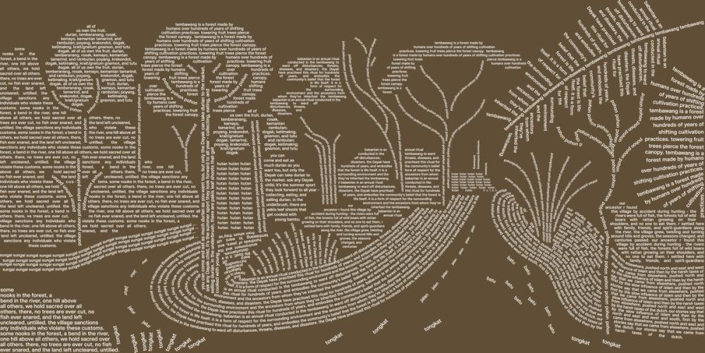
Landscapes
The typographic visuals that run throughout Issue 11 of It’s Freezing in LA! explore different ways of knowing the natural world. We begin with depictions of a patch of Indonesian rainforest. Constructed from simplistic language, these graphics depict the landscape through the reductionist lens of satellite and sensor imaging technology. We then transition to a richer, more complex typographic exploration, representing how forests are deeply entwined with the livelihoods and cultures of Indigenous and local communities.
Cartography has long been intertwined with colonial enterprise. Classifying, measuring, and assessing newly colonised landscapes was necessary for conducting colonial science and resource extraction alike. The two enterprises complimented each other – for example, new strides in scientific forestry enabled optimised planting and harvesting for ever-higher timber yields. But the nature of the scientific endeavour in the long 19th century remained close to the ground. Foresters and ecologists walked and sailed and camped and wrote and drew in situ.
The gold standard of ecosystem monitoring is now based on Earth observation data – knowing from above with the help of satellites and sensors orbiting the planet. It differs from older, more hands-on ways of knowing the natural world by orders of magnitude.
The information we receive about forests from satellites and sensors is highly abstracted. Computers process millions of pixels to generate data before they can be ‘normalised’ and ‘read’ on platforms like Google Earth. Earth observation data can tell us a lot.
AI models are often trained to measure canopy height, because the taller the tree, the greater its carbon sequestration. Yet today we’re often less interested in the complicated ecological relationships concealed on the forest floor that would have once preoccupied botanists and ecologists.
Much is missing from the top-down, reductionist imaginings of landscapes created using Earth observation instruments and complex data infrastructures. Crucially, these models eliminate Indigenous and local communities’ perspectives of the land they’ve stewarded for centuries – wisdom and histories that are often ignored as we think about how to manage and protect forests today.
So where do local, place-based knowledges fit if climate solutions predominantly draw on abstract valuations of forest carbon gathered from above? What do we miss when we count trees from space, while the people working and living under such tree canopies are missing from our datasets?
The typographic visuals shown above offer an alternative template for engaging with forests – from below, through the language, words and worldviews of forest dwellers themselves. Here, we have constructed the forest from stories and memories of a predominantly Dayak village in West Kalimantan, Indonesia (written in full on the right). What was viewed from above sharpens into a different kind of focus. Plants, animals, fruits, rivers, and mountains wander into this rendering, charged by the place and meaning they have in people’s everyday lives.
Durian trees, for example, are immensely tall – their thick light-coloured trunks readily visible from across rivers or in the distant canopy. But durian is also cherished by the community for its pungent sweet flesh, scooped out of spiky skin with bare hands. A durian tree’s value as a repository of carbon is incommensurate with its significance in Dayak community life. Myths and rituals form yet another form of knowledge that steer us through a continuous past, present, and future, where the connection between community and landscape is reiterated as one of care and stewardship.
The passages from which this second typographic visual was constructed are as follows:
I. Our stories say that we came from elsewhere, pushed north and east and west and south, first by the slow influence of Islam and then by the harsh taxes of the Dutch. Our ancestor R found this village by accident during hunting – the rivers were full of fish, the forests full of wild boars with rattan growing on their shoulders, and no one to eat them. R settled here with family, friends, and spirit guardians along the river. The village grew, twisting and turning around hills and groves, the seasons changed, and centuries passed.
II. Tembawang is a forest made by humans over hundreds of years of shifting cultivation practices. Towering fruit trees pierce the forest canopy. All of us own the fruit. Durian, temberanang, rosak, kemayo, kemantan tamarind, and rambutan; poyang, krekondot, dogak, ketimakng, krait/gnetum gnemon, and tutu dogak.
You can come and eat as much durian as you want too, but only the Dayak can take durian to the market. Ask any Dayak child, it’s the summer sport they look forward to all year – collecting, eating, and selling durian. In the underbrush, there are pakis leaf shoots that get cooked with young bambu and small dried fish.
III. Some nooks in the forest, a bend in the river, one hill above all others, we hold sacred over all others. There, no trees are ever cut, no fish ever snared, and the land left uncleared, untilled. The village sanctions any individuals who violate these customs.
IV. Babantan is an annual ritual conducted in the Tembawang to ward off disturbances, threats, diseases, and disasters. The Dayak have practised this ritual for hundreds of years, and embodies the community’s belief that the forest is life itself. It is a form of respect for the surrounding environment and the ancestors from whom they’ve inherited the Tembawang.
More Reads
Landscapes
Landscapes
more we learn about fungi, the more we realise how strange and complex they are. In this illustrated graphic novel, Holly O'Neil draws on thinking from Merlin Sheldrake, Sophie Chao, Robin Wall Kimmerer and Anna Tsing to imagine a mycological world hiding below the base of a matsutake mushroom. Pink moments spiral out from O'Neil's narrative and can been seen dotted throughout the pages of our latest special edition issue, in rhizomatic spirit.
Keep reading >
Landscapes
Landscapes